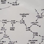
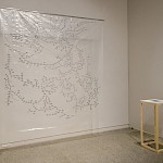
Until recently I had no idea of the complexity of the waterways comprising the catchment area for Hobart and Glenorchy’s drinking water. Tracking the terrestrial journey of this water on Google Maps I became intrigued by the names given to lakes, rivers and creeks, names that reference the area’s history and a reminder of how this region has been transformed from wilderness into landscape. For me, presenting the layout on clear polyethylene was a reference to water’s transparency while the artwork hanging in space alluded to the rainfall responsible for the flow of water through the region.
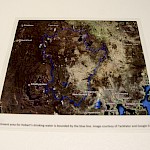
A small map detailing the extent of the Derwent River catchment (indicated by the blue line) serves to highlight how much of Tasmania contributes to the collection of this water.


